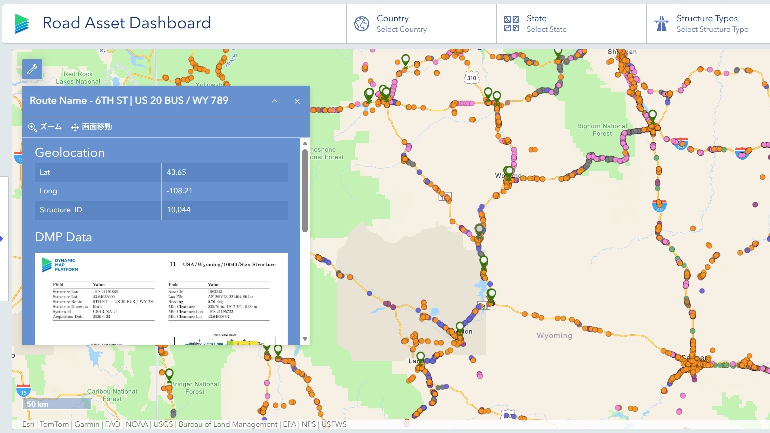




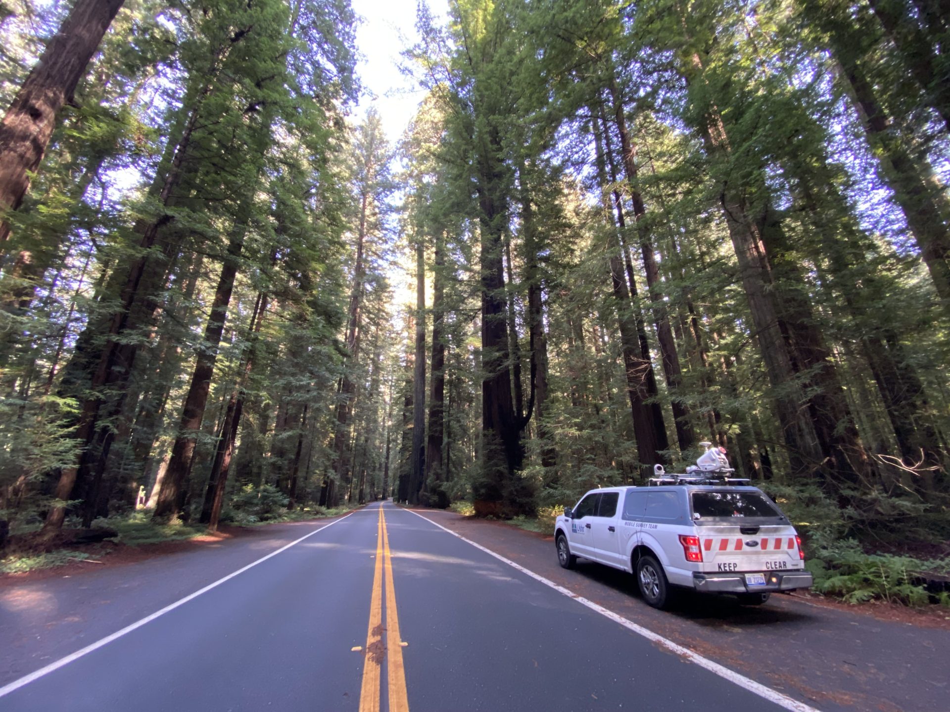
Roads, signs, utility poles, buildings, and other infrastructure that make up our cities are maintained and managed using data such as location and geometry.
But what about the trees growing right alongside those roads?
Trees are an important part of the urban environment, and as they grow, their relationship with surrounding infrastructure such as power lines, buildings, and roads also changes. If trees can be captured within the same spatial datasets as roads and utility poles, the range of information available for urban maintenance and management can be expanded further.
On October 15, 2026 (U.S. time), Dynamic Map Platform North America, Inc. participated in the ArborPro-hosted webinar “Mapping the Urban Forest at Street Level: Mobile LiDAR for Municipalities & Utilities.”Mapping the Urban Forest at Street Level: Mobile LiDAR for Municipalities & Utilities
The webinar focused on urban forestry for municipalities and utilities, covering street-level tree data collection using mobile LiDAR, tree information derived from point-cloud data, and ways to apply that information in day-to-day management operations.
Justin Byrd, Sales Director at Dynamic Map Platform North America, Inc., joined the webinar and introduced how mobile LiDAR and real-world data capabilities developed through road surveying can be applied to urban forestry.
One of the key points highlighted in the webinar was not only the information LiDAR can capture about individual trees, but also the ability to understand trees in relation to the infrastructure around them.
In this article, we revisit the topics presented in the webinar and explore the potential applications of real-world data in urban forestry.
Understanding Trees in the Context of the City
Effective management of urban trees starts with understanding what is there, where it is, and what condition it is in.
In addition to tree locations and counts, information such as height, trunk diameter, lean, crown spread, and the spatial relationship between trees and surrounding infrastructure such as roads and electric utility assets can be valuable for management.
One important perspective presented in the webinar was to view trees as infrastructure assets that form part of the urban environment.
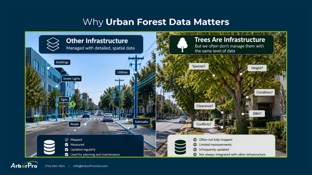
While roads, signs, utility infrastructure, and buildings are routinely mapped and measured, trees are not necessarily documented in the same way.
High-quality tree data can support not only asset inventory management, but also maintenance prioritization, budgeting, planting plans, and disaster response.
Capturing the City in 3D with Mobile LiDAR
Mobile LiDAR is one way to capture trees and their surrounding environment across a wide area.
LiDAR emits laser pulses toward surrounding objects and measures distance from their reflections. By collecting measurements while moving, for example with a vehicle, it captures large numbers of 3D points that can represent real-world objects such as roads, buildings, trees, and utility poles as point-cloud data.
Dynamic Map Platform has collected and developed real-world data on roads and their surrounding environments, primarily for mobility applications.
Applying these capabilities to urban forestry is one way to broaden the use of technologies and real-world data developed through road surveying.
From Individual Trees to Their Relationship with Surrounding Infrastructure
By identifying and classifying objects in the captured point-cloud data, trees, roads, utility poles, power lines, and other features can be represented within the same geospatial environment.
For trees, the webinar introduced metrics including:
- Tree location
- DBH (diameter at breast height)
- Tree lean
- Tree height
- Crown width
- Crown volume
- Canopy cover
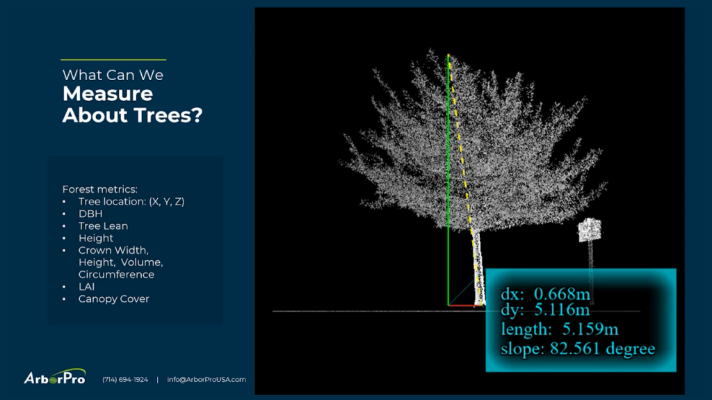
Combining this information with surrounding infrastructure makes it possible to understand not only what kinds of trees are located where, but also how those trees are positioned relative to nearby assets.
Repeated measurements of the same locations can also help identify changes over time and predict growth or decay.
Applications for Municipalities and Utilities
For municipalities, tree data has a wide range of potential applications.
The webinar highlighted applications including tree inventory management, budgeting and maintenance prioritization, planting decisions, canopy expansion, storm response, and resilience planning.
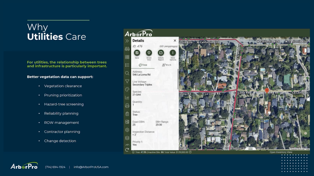
For electric utilities and other utility providers, the spatial relationship between trees and infrastructure is particularly important.
Specific applications presented in the webinar included vegetation-to-conductor proximity analysis, clearance and encroachment monitoring, circuit prioritization, work planning, post-work verification, and change detection over time.
An important point here is that the goal is not to make every decision based on data alone.
The webinar also emphasized that mobile LiDAR complements, rather than replaces, arborists and other specialists as well as field-based expertise.
Using data to understand conditions across a broad area and combining that information with professional judgment is an important part of applying data in urban forestry.
Using Data Once Collected Across Multiple Applications
The webinar also introduced an important principle for using real-world data: “Collect once, use many times.”
A single mobile mapping collection captures 3D data not only for roads, but also for signs, utility poles, buildings, trees, and other objects within the surveyed area.
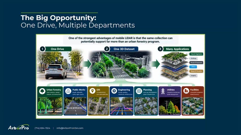
As a result, a single 3D dataset can be extended beyond urban forestry to multiple applications, including GIS, public works, engineering, urban planning, utilities, and facilities management.
Using real-world data collected once as a shared foundation for addressing a range of challenges.
This is also an important theme for Dynamic Map Platform, which has continuously collected and developed data on roads and their surrounding environments. Urban forestry is one example of how the application of our established technologies and data can be expanded into new areas.
Extending Data Developed Through Road Surveying to Broader Applications
At first glance, urban forestry may appear to be a different field from mobility and road surveying. However, the applications introduced in the webinar share a common approach: accurately capturing the real world as data and using that information to address practical challenges.
Dynamic Map Platform also operates as a data service provider in the urban forestry industry, providing mobile LiDAR and imagery data to ArborPro and other companies. Through these data services, we support the understanding and management of urban trees and surrounding infrastructure.
The webinar provided an opportunity to consider urban trees as one entry point for exploring how real-world data can be applied to a broader range of societal challenges.