




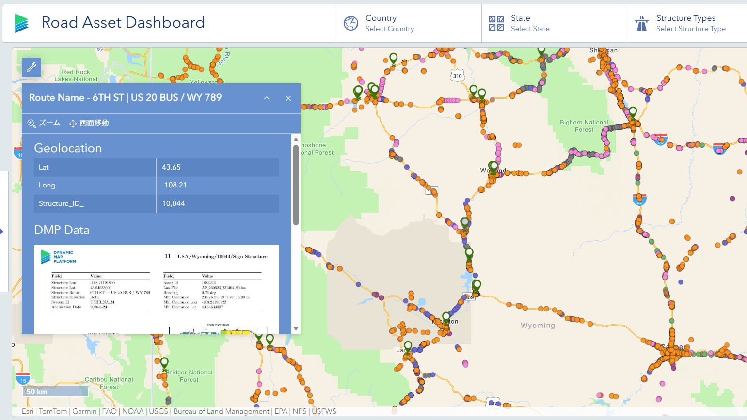
In July 2026, Dynamic Map Platform joined the Esri Partner Network (EPN) and announced its strategy to provide geospatial datasets derived from High Precision 3D Data covering approximately 1.56 million kilometers across North America through ArcGIS, Esri’s geographic information system (GIS) platform. In August, the company also made sample datasets related to Road Coverage, Signs, and Asset Clearance for the state of Wyoming publicly available on ArcGIS.
Sample Dashboard:
https://dynamicmapplat.maps.arcgis.com/apps/dashboards/b12417b48e744851ad9b6b4bf2a866d9
High Precision 3D Data digitally represents roads and surrounding environments with a high degree of accuracy. While it is widely recognized for its applications in automated driving and ADAS, it also contains a wealth of information that can be utilized for roadway management and infrastructure maintenance.
In this article, we use the sample data sets released in August to illustrate the types of roadway information that can be extracted and developed from High Precision 3D Data.
What Information Is Contained in High Precision 3D Data?
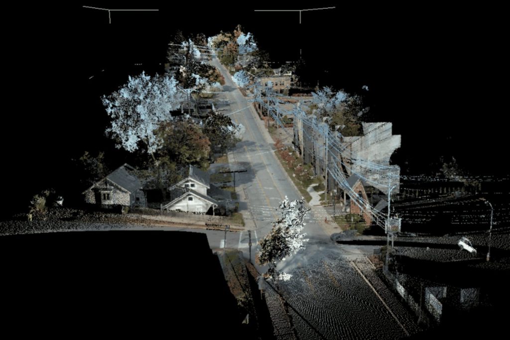
High Precision 3D Data contains more than just road and lane geometry. It also includes information related to roadway signs, roadside assets, tunnels, guardrails, and other roadway infrastructure elements.
Dynamic Map Platform captures roadway environments using Mobile Mapping Systems (MMS) equipped with LiDAR sensors and high-resolution cameras. The resulting datasets feature LiDAR measurement accuracy of up to approximately 3 mm, point cloud densities of around 1,000 points per square meter, and 360-degree imagery with resolutions of up to 72 megapixels, enabling highly accurate digital representations of roadway environments.
More Than Locations: Understanding Sign Types and Regulatory Information
When people think of roadway sign data, they often imagine simple location information showing where signs are installed. However, High Precision 3D Data can provide much more.
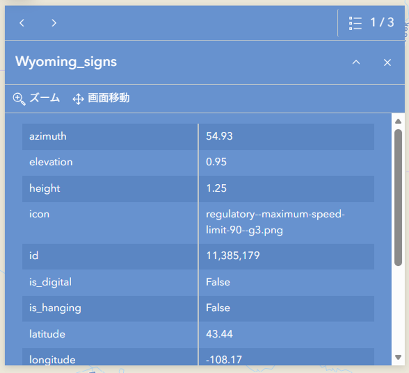
For example, the Wyoming sample dataset released in August includes attributes such as:
- Sign location
- Sign type
- Posted speed limit value
- Sign height
- Installation orientation
- Installation configuration
In other words, it is possible to understand not only that a sign exists, but also what type of sign it is, where it is located, and how it is oriented.
For roadway agencies, signs are critical roadway assets. Managing this information as geospatial data can improve inspection processes, asset inventories, and maintenance operations.
Extracting Asset Clearance Information
Asset Clearance data is another example of information that can be generated from High Precision 3D Data.
High Precision 3D Data can also be used to extract vertical clearance information and location data for roadway structures.
The publicly available sample allows users to view minimum vertical clearances and location information for roadway structures.
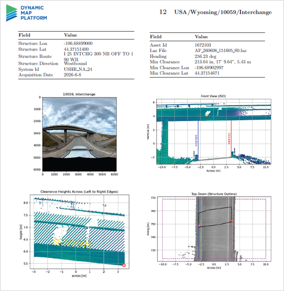
Maintaining accurate structure clearance information is an important challenge. Clearance values can change over time due to roadway resurfacing and other construction activities, creating a need for up-to-date information.
Bringing Automated Driving Data into Infrastructure Applications
Dynamic Map Platform has primarily developed High Precision 3D Data for automated driving applications. However, data that digitally represents roadway environments with high accuracy has value far beyond automated driving.
Information such as roadway sign types, regulatory details, and asset clearance information are just a few examples. The sample datasets released in August demonstrate the types of information that can be extracted and developed from High Precision 3D Data.
Moving forward, Dynamic Map Platform will continue leveraging High Precision 3D Data as a foundational spatial information platform supporting social infrastructure while promoting broader utilization of data across roadway management, infrastructure maintenance, disaster preparedness, urban planning, and other fields.
View the sample data on ArcGIS:
https://dynamicmapplat.maps.arcgis.com/apps/dashboards/b12417b48e744851ad9b6b4bf2a866d9