



Dynamic Map Platform North America, Inc. (“DMP NA”), a group company of Dynamic Map Platform Co., Ltd. (Head Office: Shibuya-ku, Tokyo; CEO & President: Shuichi Yoshimura; “Dynamic Map Platform”) will participate as a speaker in the ArborPro Webinar – Mapping the Urban Forest at Street Level: Mobile LiDAR for Municipalities & Utilities, to be held on October 15, 2026 (U.S. time).
The webinar will focus on Urban Forestry for municipalities and utility organizations and will introduce methods for collecting and utilizing tree-related data using mobile LiDAR. Representing DMP NA, Sales Director Justin Byrd will discuss LiDAR fundamentals, street-level data collection using mobile LiDAR, and the potential application of real-world data acquired through road mapping for urban forestry use cases.

In recent years, municipalities and utility organizations engaged in urban forestry have faced challenges associated with the significant time and labor required for tree inventory and management.
By leveraging real-world data, organizations can digitally manage individual trees and obtain key measurements such as tree height, crown diameter, and diameter at breast height (DBH). The data can also be used to identify potential conflicts between trees and surrounding infrastructure such as power lines and buildings. As a result, activities that traditionally require extensive fieldwork, including tree surveys and inventory maintenance, can be performed more efficiently, allowing arborists and forestry professionals to concentrate on higher-value activities such as tree health assessment, preservation planning, and infrastructure conflict mitigation.
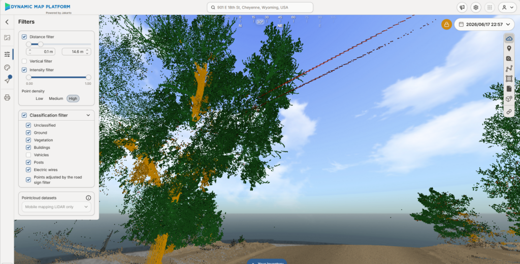
Dynamic Map Platform continuously collects and maintains real-world data covering roads and surrounding environments across 26 countries worldwide, including North America, primarily to support autonomous driving and other mobility applications. This data infrastructure is expected to support applications beyond mobility and road management, including roadside vegetation and urban forestry management.
In addition, by combining previously accumulated datasets with newly collected data, organizations can track and compare changes in trees over time within the same area. Beyond understanding current conditions, such time-series analysis can support maintenance planning and other emerging data-driven approaches to urban forestry.
As a provider of real-world data services, Dynamic Map Platform supports municipalities, utility organizations, and businesses seeking to utilize data in urban forestry.
Dynamic Map Platform will continue expanding the application of real-world data beyond mobility into new domains and industries.
<Webinar Overview>
| Title | ArborPro Webinar – Mapping the Urban Forest at Street Level: Mobile LiDAR for Municipalities & Utilities |
| Date & Time | October 15, 2026 11:00 AM PST / 12:00 PM MST / 1:00 PM CST / 2:00 PM EST |
| Format | Online |
| Speakers | ✓Dr. Brice Zoungrana, Director of Geospatial Technologies, ArborPro, Inc. ✓Micah Kikuchi, General Manager, UPE Resources, Inc. ✓Justin Byrd, Sales Director, Dynamic Map Platform North America, Inc. |
| Key Topics | ✓LiDAR fundamentals and benefits ✓Street-level tree data collection using mobile LiDAR ✓Tree information derived from point cloud data ✓Applications for municipalities and utility organizations ✓Comparison of mobile LiDAR and conventional tree inventory methods |
| Participation Fee | Free |
| Registration | https://events.teams.microsoft.com/event/f2d0c4c3-d7b2-461c-8eaa-456cf2b2cd52@bcc207e6-c44b-4ba6-8995-7cfd63f78aad |
