As U.S. transportation agencies accelerate the adoption of GIS and digital infrastructure, the 2026 AASHTO GIS for Transportation Symposium served as a key forum for sharing real‑world applications and future directions in mapping, mobility, and infrastructure management. Held in Chicago, Illinois, from March 16 to 19, the symposium brought together public agencies and industry partners to discuss how geospatial data can support transportation planning, safety initiatives, and operational efficiency.
AASHTO GIS‑T is a specialized task force and annual symposium under the American Association of State Highway and Transportation Officials (AASHTO). The event provides a platform for the U.S. Department of Transportation and transportation agencies to exchange initiatives and case studies related to GIS and geospatial technologies, with a focus on their practical use in transportation planning, asset management, and infrastructure operations.
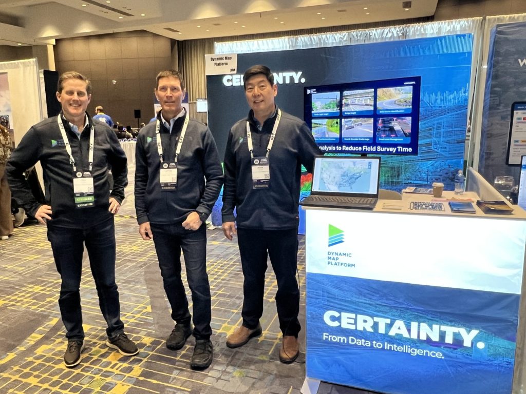
During the symposium, Dynamic Map Platform North America, Inc. participated for the first time, presenting concrete examples of how high‑precision 3D geospatial data can be used as foundational, ground‑truth data. Demonstrations included North America–wide 3D map coverage, V2X‑related systems, and traffic management simulations, highlighting the growing role of detailed geospatial data in supporting digital infrastructure and cross‑sector collaboration.
DMP NA’s booth was visited by attendees from many State DOTs, AEC industry professionals, and other GIS technology partners. Our team engaged in fruitful conversations about the application of 3D data content in a variety of use cases, including transportation infrastructure and public policy.
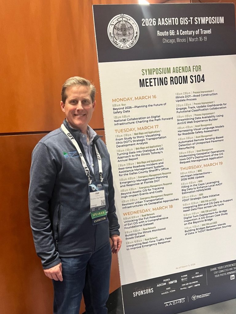
Additionally, Trip Bonds, Vice President of Sales & Marketing at DMP NA, spoke at a workshop hosted by the U.S. Dept. of Transportation entitled, “National Collaboration on Transportation Digital Infrastructure: Charting the Path Forward”. The workshop was well-attended by representatives from many U.S. States. The speakers and audience were able to converse and exchange views on the current status and challenges to modernize Digital Infrastructure leading to a healthy dialogue about the importance of Interoperability, Investments, and Public-Private partnerships. Since DMP was founded with a Public-Private partnership in Japan, the concept of broad-based collaboration in the United States is a natural extension of our company’s mission.
Trip presented on the current state of geospatial data being used for the operational design domain of Automated Vehicles and the application of this data to different domains. The broader category of Autonomous Machines (which includes terminal & material handlers, humanoid robots, and unmanned aerial vehicles) needs accurate digital models of the real-world in order to be developed, simulated and operated properly. From a public policy and governance point of view, it is important that U.S. federal and state road authorities adapt quickly to this changing world by leveraging existing technologies.
Dynamic Map Platform is working globally and locally to modernize digital infrastructure around the world. By leveraging its experience and advantages in High-Precision 3D Data through national and regional collaboration activities, DMP continues to lead the way to a Digital World in Japan and overseas.
<Overview of the “2026 AASHTO GIS for Transportation Symposium”>
| Date | March 16 (Mon) – 19 (Thu), 2026 |
| Venue | McCormick Place Convention Center (Chicago, Illinois, USA) |
| Organizer | American Association of State Highway and Transportation Officials (AASHTO) |
Official Website: https://web.cvent.com/event/8f1699e7-19ff-49cc-a49e-1ad1c7da480e/summary