Dynamic Map Platform Co., Ltd. (Head office: Shibuya-ku, Tokyo; “Dynamic Map Platform”) announces that it has implemented a functional update to its subscription service 3Dmapspocket®, which enables users to view 3D point cloud data.
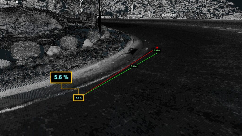
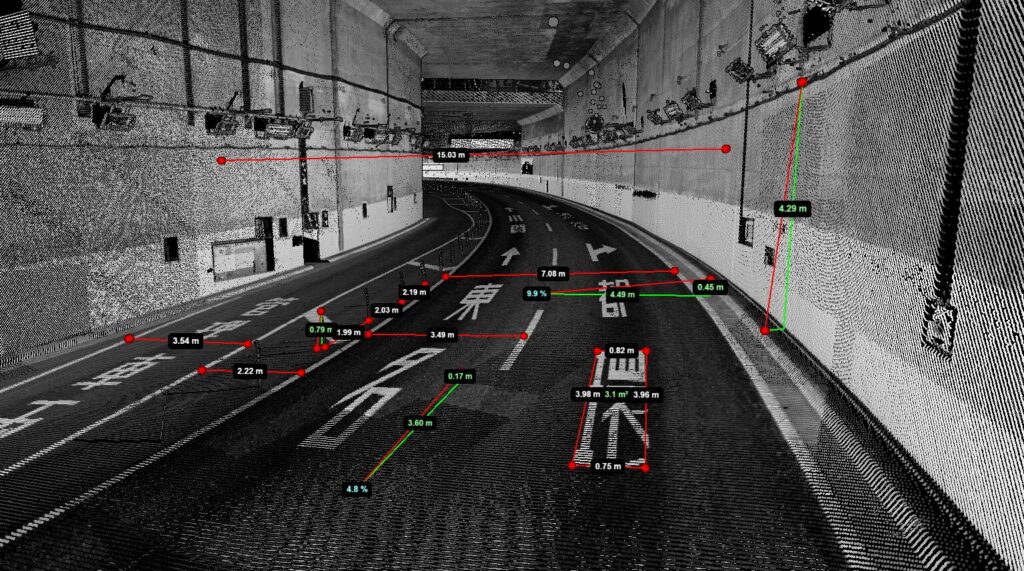
3Dmapspocket® is a data platform that enables users to confirm and analyze the 3D point cloud data from expressways/dedicated vehicle routes and major trunk roads across Japan acquired by Dynamic Map Platform. This functional update has made it possible to automatically calculate the gradient of a road (percentage) between two selected points.
It was already possible to measure the distance or height between two points, but the company has added a gradient measuring function based on requests from users. With this, the service will have an increased range of uses in different settings, including more detailed on-site inspections as part of traffic accident investigations and pre-inspection advance location confirmation for road maintenance management.
Dynamic Map Platform will continue striving to enhance the usage value for users through functional updates to its services.
<About the point cloud data viewing service 3Dmapspocket®>
This is a subscription service that enables users to confirm and analyze the 3D point cloud data acquired by Dynamic Map Platform.
It uses mobile mapping systems* to measure expressways/dedicated vehicle routes and major trunk roads across Japan, providing the data in a way that unifies its vast amount of measurement data. The service can be used for diverse purposes, including solving road traffic issues, and is expected to be utilized for a variety of purposes as a high-precision location information platform that contributes to the realization of labor-saving and further efficiency and the creation of safe and secure environments.
· Details of service: https://3dmapspocket.dynamic-maps.co.jp/