Dynamic Map Platform Co., Ltd. (Head Office: Shibuya-ku, Tokyo; CEO & President: Shuichi Yoshimura; “Dynamic Map Platform”) has implemented a functional update to its subscription service 3Dmapspocket®, which enables users to view 3D point cloud data. Based on user feedback, Dynamic Map Platform has significantly redesigned the user interface (UI) and added a feature to select English as the display language.
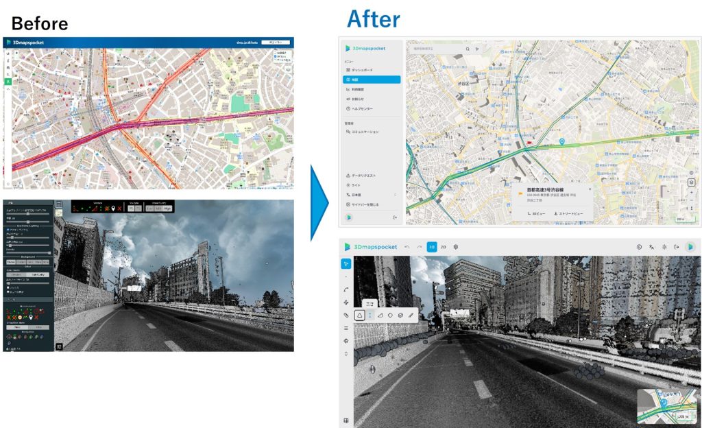
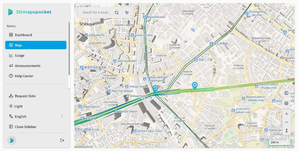
3Dmapspocket® is a data platform that allows users to view and analyze 3D point cloud data of nationwide expressways/motorways and major arterial roads acquired by Dynamic Map Platform. In this update, the UI has been renewed to provide a more intuitive user experience by improving the design to have higher visibility overall and making user navigation to frequently used features smoother.
Additionally, most of the current users of this service are domestic. However, Dynamic Map Platform has implemented an English display language feature in preparation for building a global user base in the future by leveraging its strength—international data coverage.
The items implemented in this functional update, including the above points, are as follows:
- Redesigned the UI to make it more intuitive
- Added a feature for switching the display language to English
- Added undo and redo features
- Improved navigation to frequently used features
- Improved loading speed
Dynamic Map Platform will continue striving to enhance the usage value for users through functional updates to its services.
<About the point cloud data viewing service 3Dmapspocket®>
This is a subscription service that enables users to confirm and analyze the 3D point cloud data acquired by Dynamic Map Platform.
It uses mobile mapping systems* to measure expressways/dedicated vehicle routes and major trunk roads across Japan, providing the data in a way that unifies its vast amount of measurement data. The service can be used for diverse purposes, including solving road traffic issues, and is expected to be utilized for a variety of purposes as a high-precision location information platform that contributes to the realization of labor-saving and further efficiency and the creation of safe and secure environments.
- Details of service: https://www.dynamic-maps.co.jp/en/service/viewer/
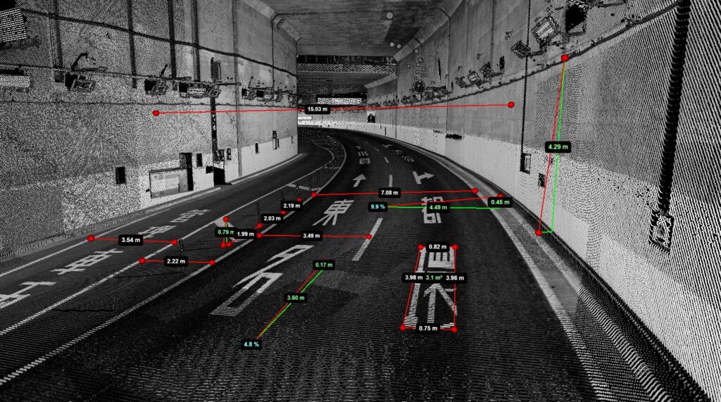
*Mobile Mapping System (MMS): A vehicle-mounted measuring system that is capable of measuring roads and their surrounding structures in 3D using measuring instruments such as GPS, cameras, laser scanners, and IMU (Inertial Measurement Units).