Dynamic Map Platform Axyz Co., Ltd.( Head Office: Shibuya-ku, Tokyo; CEO & President: Hiromichi Amagai; “Axyz”), a group company of Dynamic Map Platform Co., Ltd. (Head Office: Shibuya-ku, Tokyo; CEO & President: Shuichi Yoshimura; “Dynamic Map Platform”), has partnered with JAL Ground Service Co., Ltd. (Headquarters: Ota-ku, Tokyo; President and CEO: Osamu Ueshima; “JAL Ground Service”) to start field testing at New Chitose Airport utilizing Axyz’s snow removal support system “SRSS,” which applies High-Precision 3D Map Data, for guidance during aircraft pushback operations.
■Background of the field test
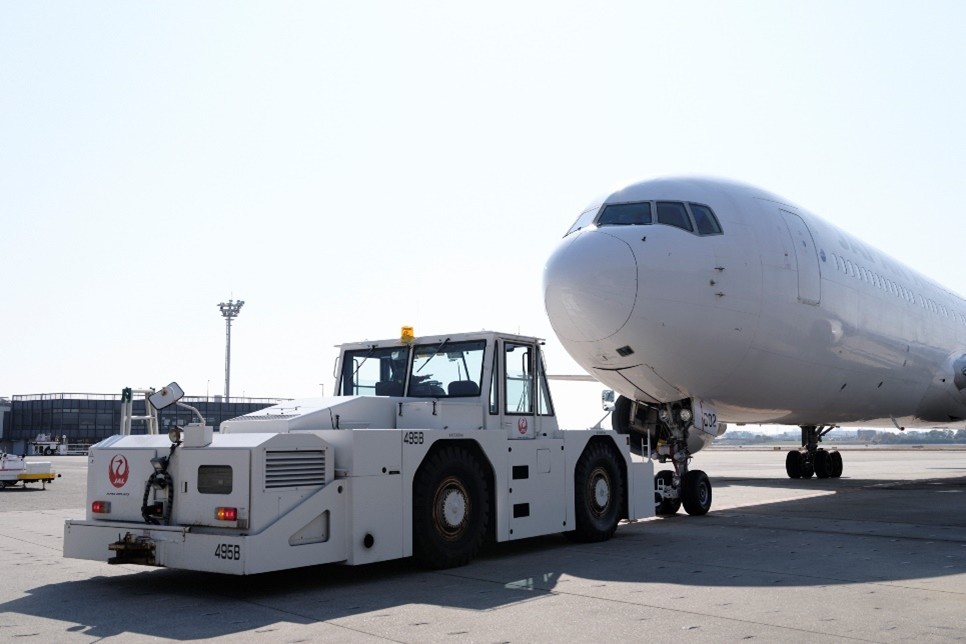
Aircraft cannot move backward on their own, so when an aircraft ready for departure heads toward the runway, a specialized vehicle called a tow truck pushes the aircraft to the taxiway in a process called “pushback.”
While pushback is a routine operation at airports, it is a highly challenging task that requires constant attention to detail, skilled expertise, and smooth coordination among all parties involved. Especially during snowfall or rain, when visibility is poor, it becomes difficult to identify the aircraft’s intended path, and tow truck operators must perform more cautious and advanced driving maneuvers to avoid collisions with other aircraft or ground equipment.
■Contents of the field test
Axyz’s snow removal support system, “SRSS,” provides guidance by projecting the high-precision self-positioning information of snow removal vehicles onto High-Precision 3D Map Data that includes information on snow-covered road shoulders and road structures. In this field test, SRSS will be used not for snow removal but for guidance during pushback operations by tow trucks. High-Precision 3D Map Data for the target area will be created, and the experiment will verify whether safe operations can be performed by referencing the map via SRSS. Field testing will run for one year, with a focus on verifying improvements in visibility during snowfall and rainy conditions, where significant safety benefits are expected.
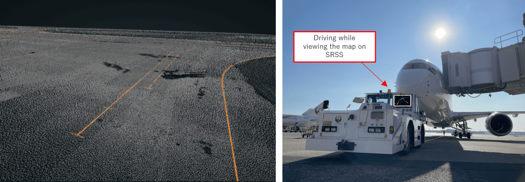
(Right) Image of SRSS use during aircraft pushback
<Overview of field testing>
・Duration: Wednesday, January 22, 2025 to Wednesday, January 21, 2026
・Target area: New Chitose Airport Apron – Taxiway
・Demonstration details: Verification of safety improvements through the use of the snow removal support system “SRSS” as guidance during aircraft pushback
<About the snow removal support system “SRSS”>
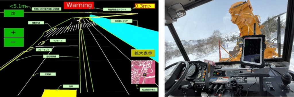
SRSS is a service customized by Axyz for snow removal operations and combines Dynamic Map Platform’s HD Maps (High-Precision 3D Map Data), also used for autonomous driving, with “RTK positioning*1” utilizing “CLAS*2,” which can estimate one’s location with high accuracy. It supports safe and smooth snow removal operations by making shoulders, manholes, and other structures hidden under the snow “visible” on a tablet while understanding the vehicle’s position through high-precision location information from a GNSS receiver.
Service Details: https://www.dynamic-maps.co.jp/srss/
*1 RTK positioning: A positioning method that makes use of the GNSS (Global Navigation Satellite System). It is possible to request location information with high precision at a level of centimeters.
*2 CLAS: Supplementary information distributed from quasi-zenith satellites (Michibiki)