Dynamic Map Platform Co., Ltd. (CEO & President: Shuichi Yoshimura; “Dynamic Map Platform”) has been entrusted with an R&D project to develop dynamic maps for public areas by the Ministry of Economy, Trade and Industry. This is one of the measures of the Cabinet Office’s “programs for Bridging the gap between R&d and the IDeal society (society 5.0) and Generating Economic and social value,” also known as BRIDGE.
The “Development of Dynamic Maps for Public Areas” aims to develop an environment for a digital society such as Society 5.0 in which diverse mobility with autonomous transport , including automobiles, can operate safely and efficiently in any space. Dynamic Map Platform’s goal is to realize the safe and efficient operation of automated driving vehicles in airports and port facilities, where there is a need for labor-saving with regard to vehicle work due to manpower shortages.
In the airport industry, the public and private sectors are working collaboratively on “aviation innovation” using advanced technologies, focusing on the issue of a lack of manpower in airports despite an increase in inbound demand, with further increases expected in the future.
In the logistics industry, which includes port facilities, responding to the shortage of drivers that will result from the “2024 problem” of driver working hours being reduced is an urgent issue.
– Airports
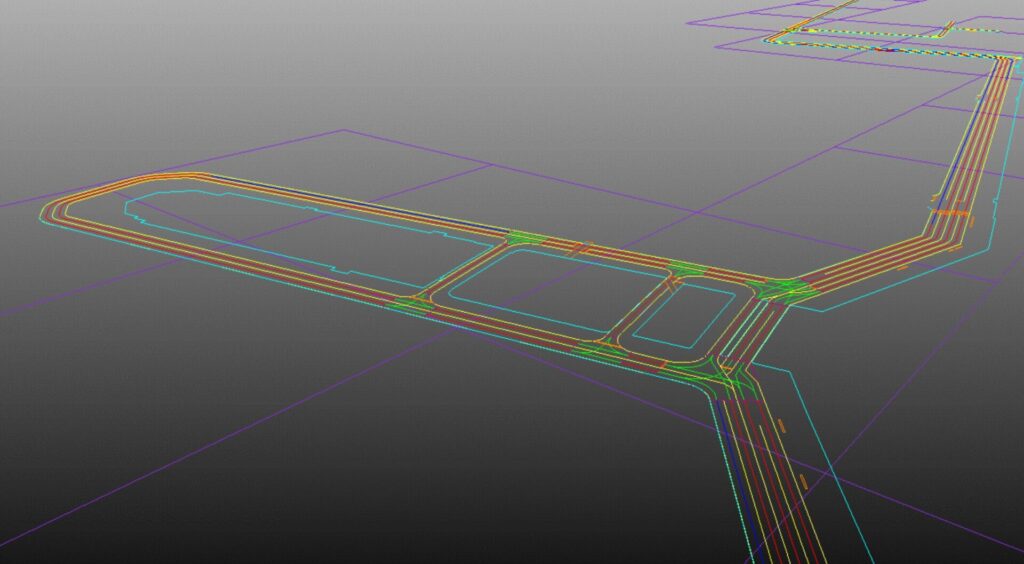
There are strictly regulated driving routes on airport premises to avoid contact with aircraft, various types of work vehicle, and key facilities. Airport premises have few of the features required for automated driving via sensors, such as white lines, but it will be possible to realize the safe operation of automated driving vehicles on such premises by using dynamic maps developed based on high-precision 3D data to specify accurate virtual driving routes.
– Port facilities
When it comes to logistics that use ports, such as container transportation, the industry has constructed logistics networks that make use of public roads and expressways from port facilities.
Combining dynamic maps of the inside of port facilities and Dynamic Map Platform’s High-Precision 3D Map Data of expressways and public roads will make it possible to realize automated driving services that can seamlessly move from public areas to public roads.
Dynamic Map Platform also aims to use its global business structure in North America, Europe, and other locations for the global development of the outcomes obtained from this research, including the creation of international standards for dynamic maps for public areas.
The application of Dynamic Map Platform’s high-precision 3D data for automobiles is expanding in Japan and North America as a tool to realize autonomous driving and advanced driver-assistance systems. Dynamic Map Platform also hopes to utilize it in a variety of areas, including MaaS operation, control of flight vehicles such as drones, disaster-prevention, and infrastructure management.
Dynamic Map Platform contributes to solutions to social issues such as manpower shortages using the know-how it has cultivated through the provision of high-precision 3D data.
<What is BRIDGE?>
This is short for “programs for Bridging the gap between R&d and the IDeal society (society 5.0) and Generating Economic and social value.”