In the first issue of this column, we will explain what the dynamic map in our company name means and how it relates to the High-Precision 3D Maps (high-definition maps; HD maps) we develop and provide.
Categorization Into Four Layers Based on Time Intervals
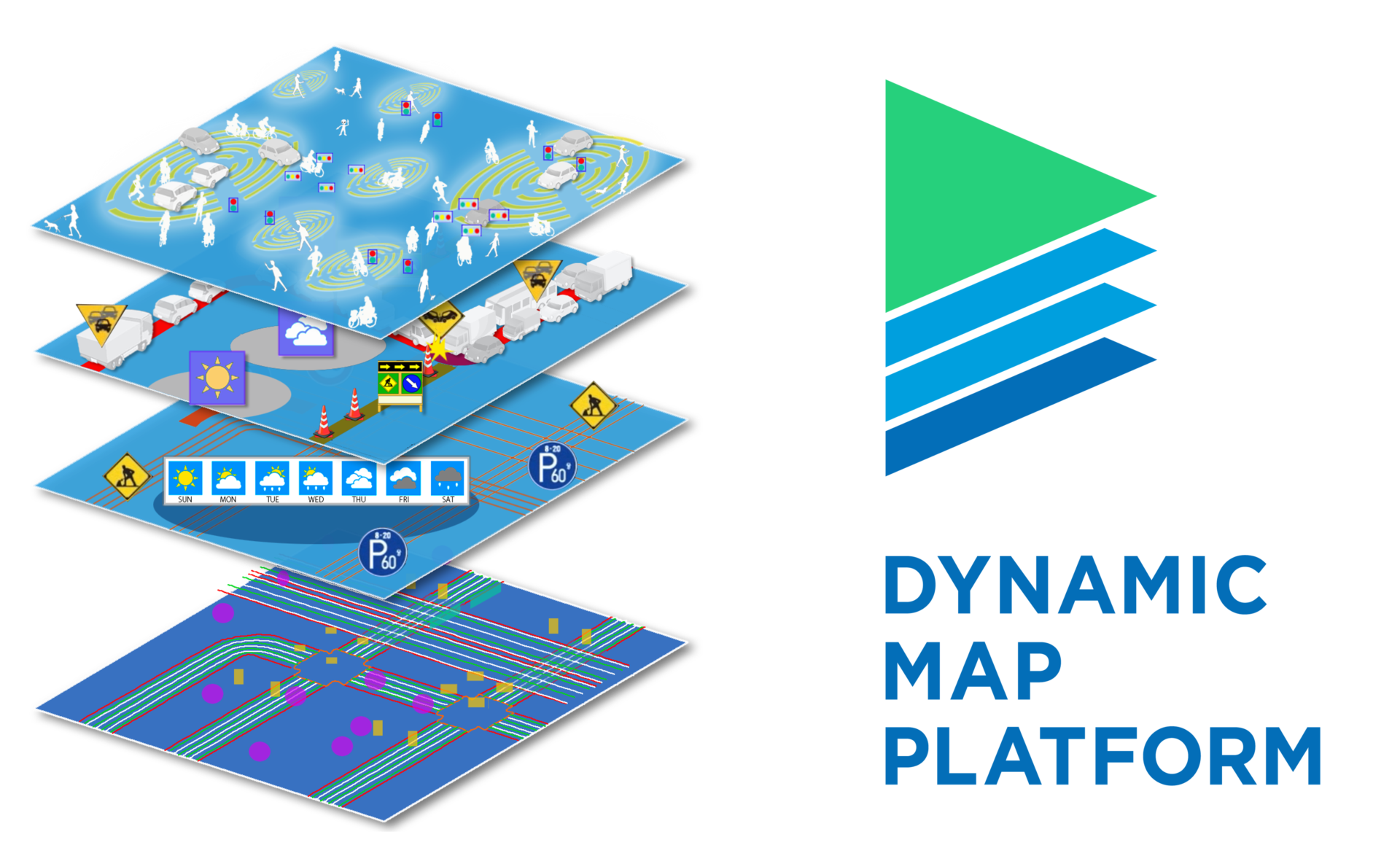
A dynamic map is a digital map data model integrating a variety of information from road spaces required for realizing autonomous driving systems.
In this model, each piece of information is categorized into one of four layers depending on how frequently it changes, and the information in each layer is linked and used based on its position. The structure of the four layers comprises the following:
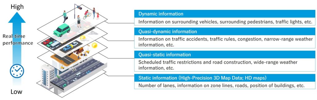
(1) dynamic information that changes by the second or minute (traffic light information, dropped objects, etc.);
(2) quasi-dynamic information that changes by the hour (information on weather, traffic congestion, traffic restrictions, etc.);
(3) quasi-static information that changes by the day (information on scheduled road construction and traffic restrictions, etc.); and
(4) static information that changes by the month or year (information on road surfaces and lanes, 3D structures, etc.).
Our company is named Dynamic Map Platform because it takes on the role of providing static information, which acts as the foundation among the four layers of the HD maps we provide. Incidentally, have you noticed that the design of our logo symbolizes these four layers?
The Difference Between In-Car Navigation Maps and HD Maps
Now, when it comes to digital maps installed in cars, there are the familiar in-car navigation maps. These maps are meant to be read by humans, namely drivers. They display road-level and facility-related information in 2D, and the location precision of their data is generally at the meter level. Since the driver is the one in control of driving operations, it is acceptable that the location is only accurate to a few meters.
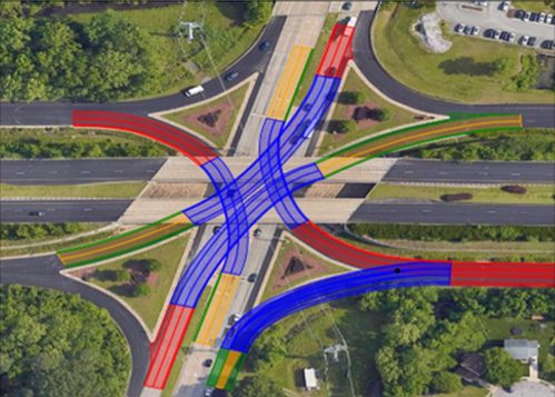
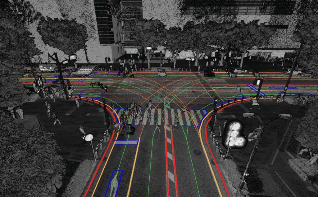
On the other hand, maps designed for autonomous driving are read by machines—the cars—and used to control driving operations. Therefore, drifting into the next lane or stopping over the stop line is not tolerated. HD maps convert road features, such as white lines, stop lines, and traffic lights, into 3D data with centimeter-level location precision at the lane level. Furthermore, HD maps convert the curvature of road curves and road gradient information into 3D with high precision and support safe acceleration/deceleration and smooth steering in autonomous driving systems. In terms of global warming countermeasures, precise gradient information has been shown to function effectively in reducing fuel consumption and electricity consumption in electric vehicles in Europe and the US.
Serving as a Bridge Between Real Space and Digital Space
Recently, development has been shifting in full swing from standalone HD maps installed in individual vehicles to dynamic maps. By linking the information mentioned above—from dynamic to quasi-static information—with HD maps as the foundation, autonomous driving systems can use a variety of information along the driving route, such as construction information, traffic congestion status, and hazardous areas caused by sudden weather changes like localized downpours, for controlling driving operations. In Japan, national R&D projects and field testing by road administrators have been actively taking place, and Dynamic Map Platform has also been participating in various projects. Moreover, to expand this concept of dynamic maps to fields other than public roads, Dynamic Map Platform has been engaging in studies and field testing involving special cars in facilities like airports and plants.
Through these projects, we aim to continue serving as the digital twin foundation that enables a common representation of the real (physical) space, where people and various forms of mobility operate and function, and the digital (cyber) space, which is recognized, understood, and controlled by the system.