Making construction information and other information normally managed on paper usable for both people and mobility through digital, uniform management
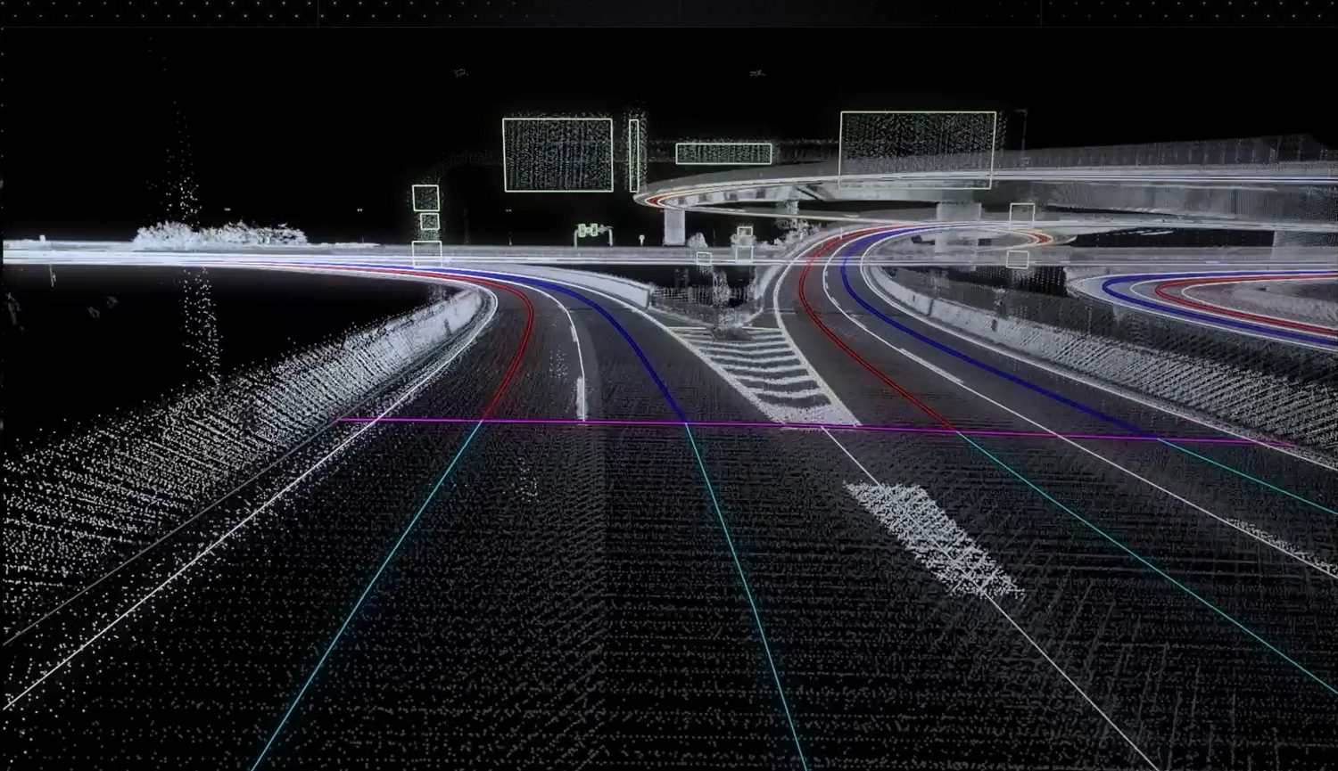
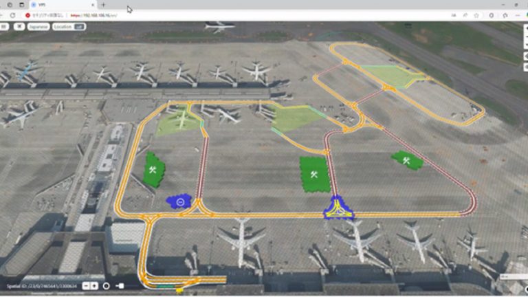
Map information from within the airport, such as service lanes* and other structures, is registered on VIPS in advance. Within this, dynamic information such as no-entry or impassable areas (e.g. where there is construction work or a standstill due to a broken-down vehicle) is recorded as necessary.
People are then able to check and use this VIPS information on their tablets. They can also use this system as the basis for autonomous driving mobility operations together with HD maps, enabling them to select and operate safer driving routes by changing driving lanes and avoiding areas with service lanes that will be hard to pass through.
At the moment, construction information is almost always managed on paper—managing it digitally with VIPS will contribute to improved efficiency and convenience in the duties carried out by employees working on site.
*Routes that cross aircraft travel routes
Use cases for which VIPS provides solutions
VIPS can be applied to use cases such as the following. In addition to airport management companies, it is targeted at businesses such as airlines, mobility manufacturers, and ground handling companies, and aims to suggest solutions to issues. The assumed recipients of the information are autonomous driving mobility services, businesses, and airport managers, but the information will be distributed as necessary to the users who need it in accordance with the use case.
| Examples of use cases | Destination of information distribution (user) |
|---|---|
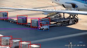
| Provision of information about obstructions using information from cameras in blind-spot areas located at intersections, etc. | Mobility services, Businesses |
| Provision of information about towing tractor locations and the locations and sizes of the containers being transported. | Mobility services, Businesses, Airport managers |
| Provision of service lane surveillance information from cameras. | Mobility services, Businesses |
| Provision of information about areas that cannot be used for passage. | Mobility services, Businesses, Airport managers |
| Sharing the current status of areas where ground handling equipment is standing by. | Mobility services |